
It’s About Time
Jessica Intermill & Lib Loeb (BugNip Press 2026)
Bdote
Scroll right to view images of Bdote over time
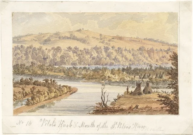
Seth Eastman, Pilots Knob Mouth of the St. Peters River, 1846, watercolor on paper, Minnesota Historical Society, AV1991.85.23.
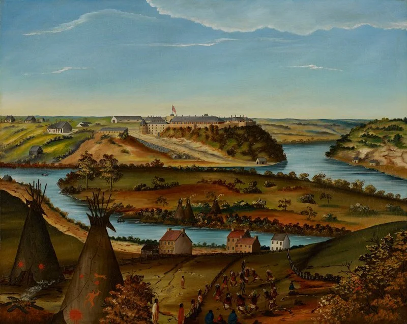
Edward K. Thomas, View of Fort Snelling, c. 1850, oil on canvas, Minneapolis Institute of Art, 44.21.
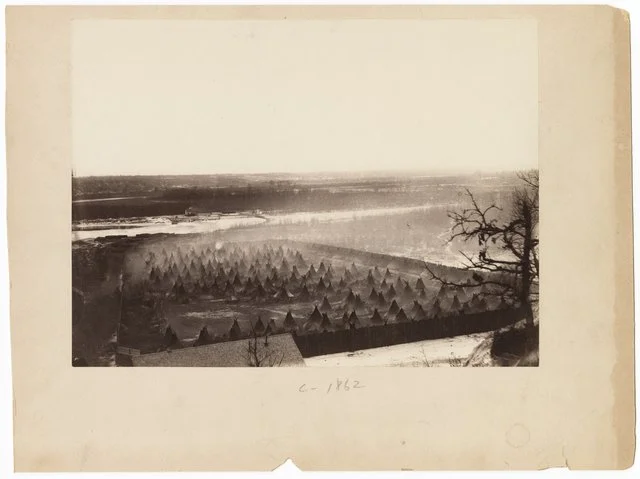
Benjamin Franklin Upton, Captured Sioux Indians in fenced enclosure on Minnesota River below Fort Snelling, c. 1862, photonegative, Minnesota Historical Society, E91.4S p53.
American Progress
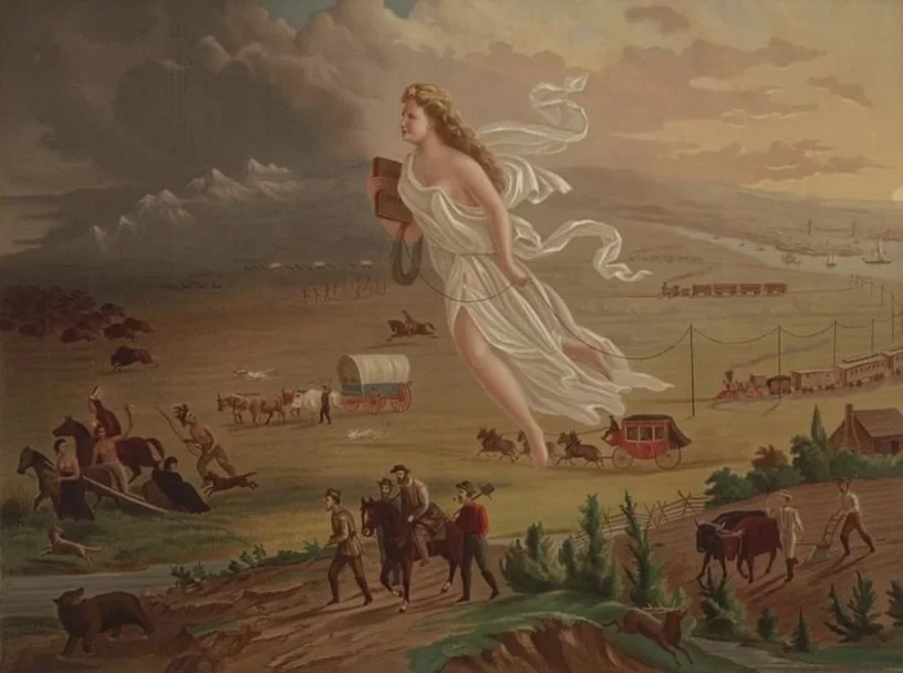
John Gast, American Progress, 1873, oil on canvas, Library of Congress, LC-DIG-ppmsca-09855.
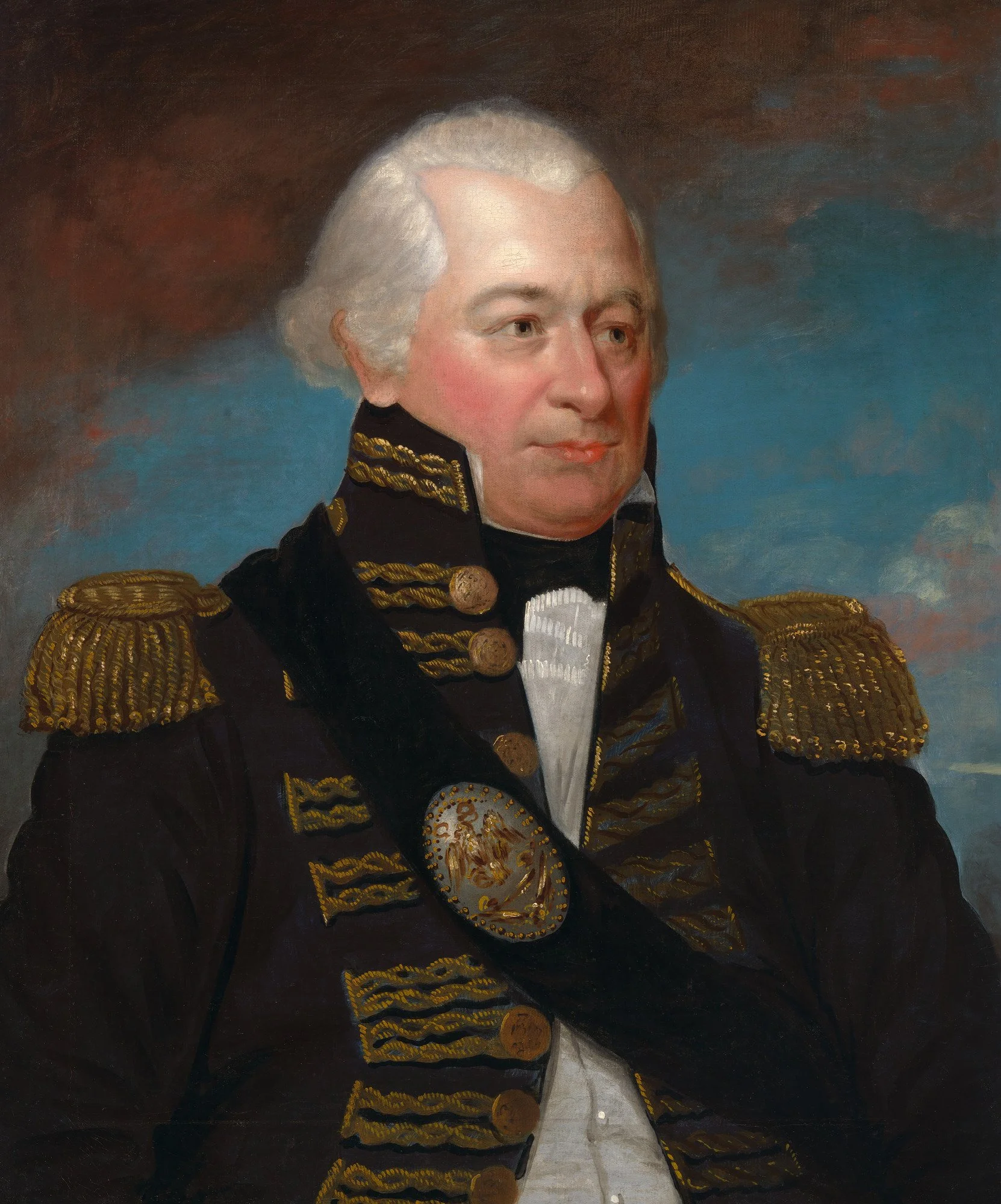
General James Wilkinson
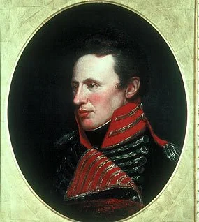
First Lieutenant Zebulon Pike
Charles Willson Peale, Zebulon Montgomery Pike, 1808, painting, Smithsonian, IAP 46020262.

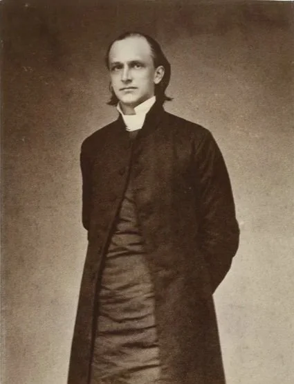
Bishop Henry B. Whipple
J. Russell & Sons, Henry B. Whipple, c. 1860, photoprint, Minnesota Historical Society, AV2002.169.450.
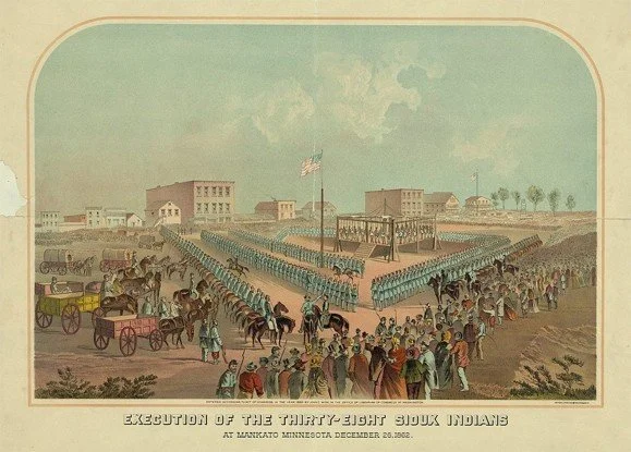
Public Execution
John C. Wise, Execution of the Thirty Eight Sioux Indians At Mankato Minnesota December 26, 1862, 1883, color lithograph, private collection, accessed Aug. 4, 2026.
Minneapolis
Maps show the city segregate over time
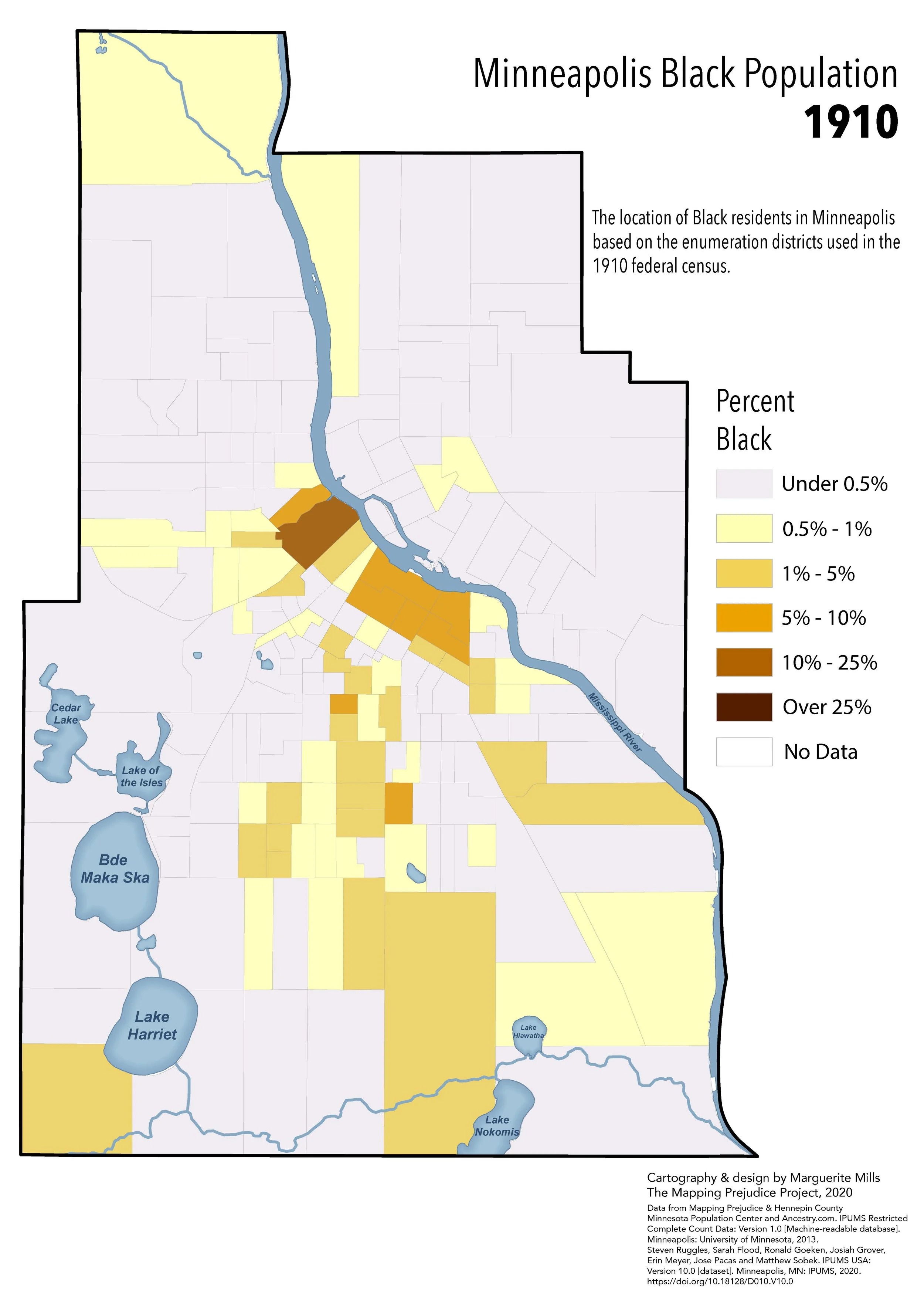
Marguerite Mills, “Minneapolis Black Population 1910,” Mapping Prejudice Project, Mapping Prejudice, accessed Aug. 11, 2026.
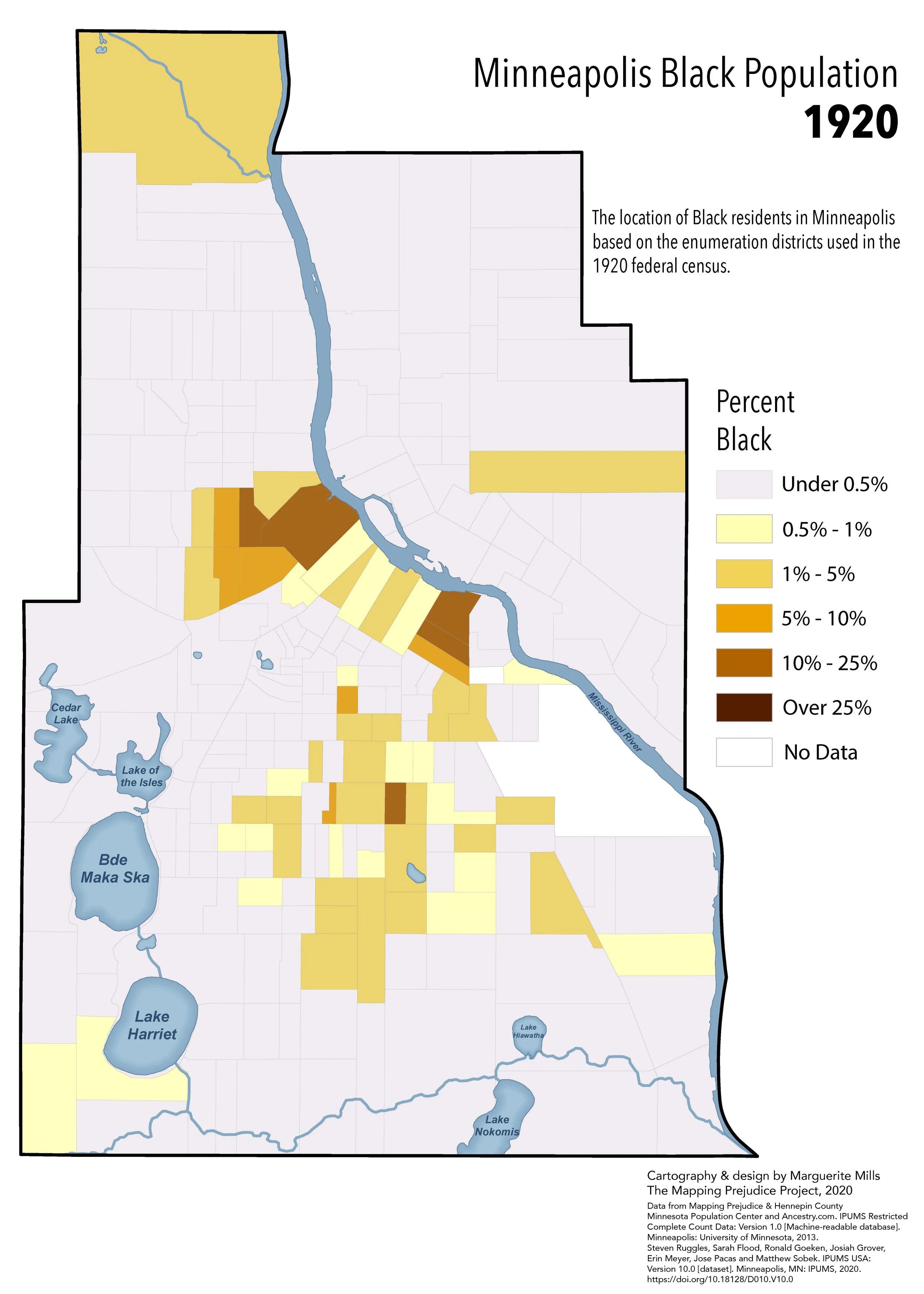
“Minneapolis Black Population 1920,” Mapping Prejudice Project, Mapping Prejudice, accessed Aug. 11, 2026.
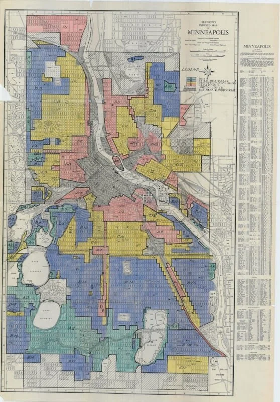
Map of redlining in Minneapolis, c. 1935, accessed Aug. 4, 2026 at “Race and Housing Series: Redlining and Resistance– An Interview with Dr. Brittany Lewis.”
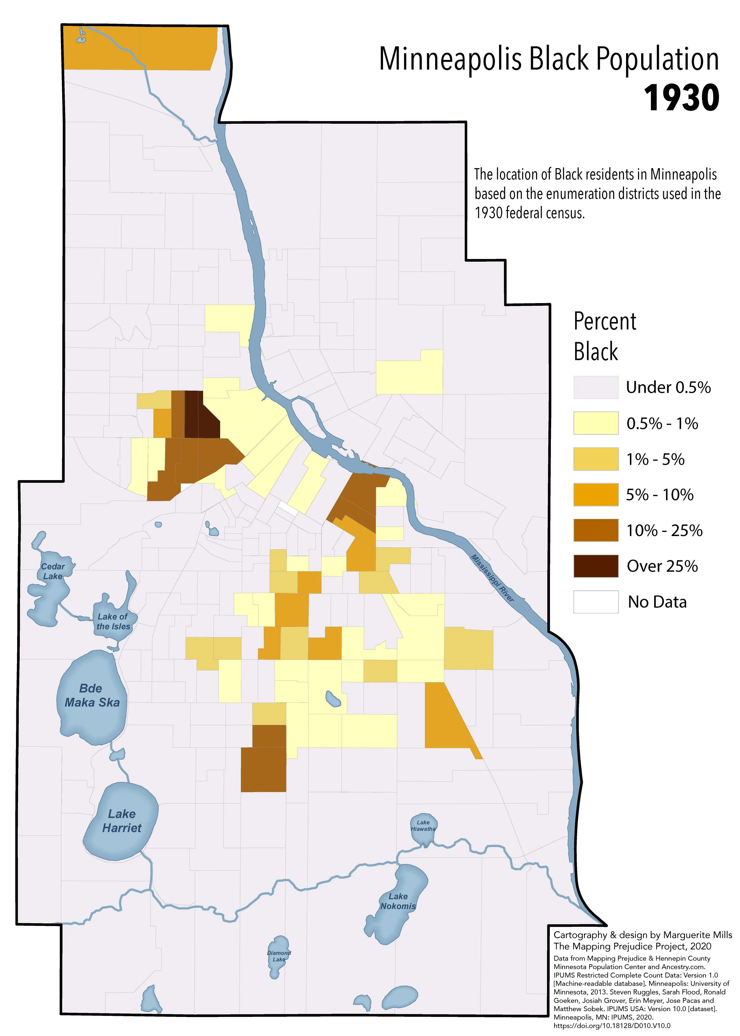
Marguerite Mills, “Minneapolis Black Population 1930,” Mapping Prejudice Project, Mapping Prejudice, accessed Aug. 11, 2026.
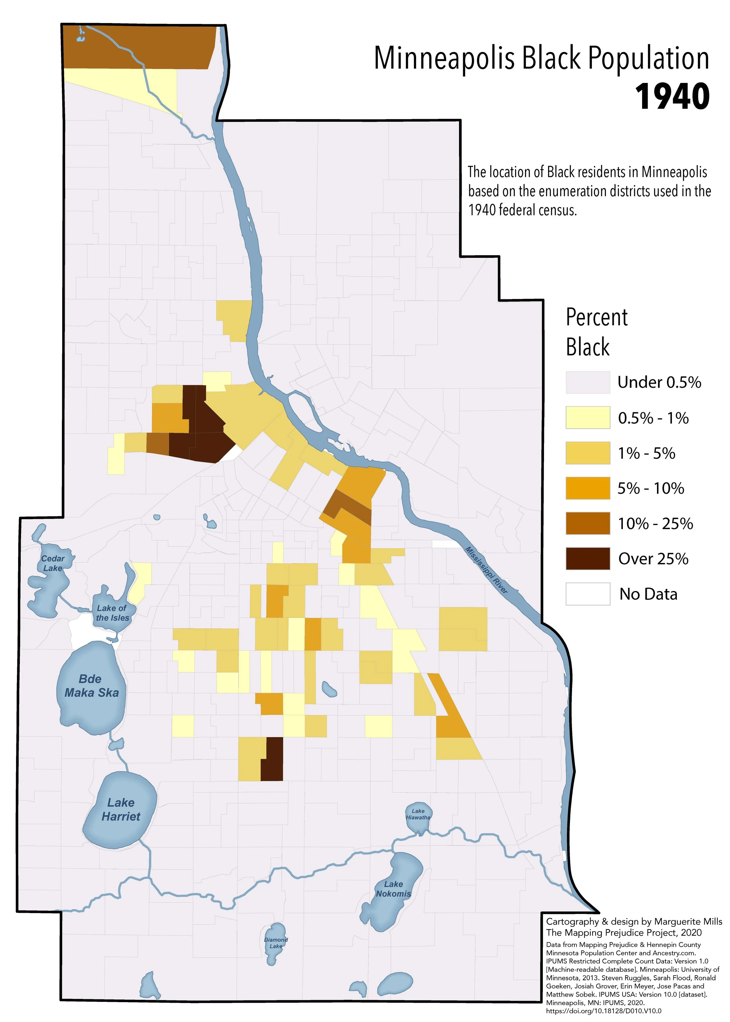
Marguerite Mills, “Minneapolis Black Population 1940,” Mapping Prejudice Project, Mapping Prejudice, accessed Aug. 11, 2026.
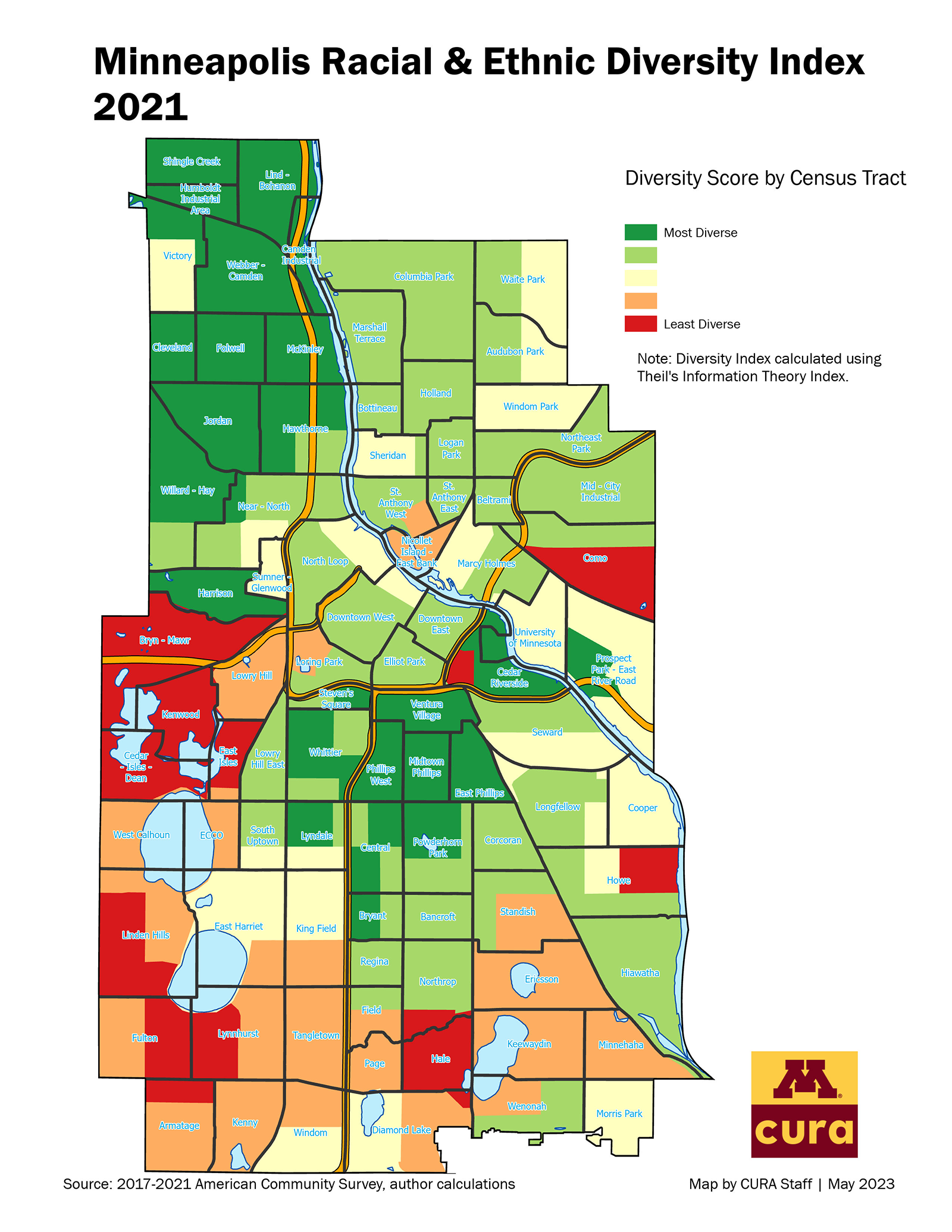
University of Minnesota Center for Urban & Regional Affairs, "Minneapolis Racial & Ethnic Diversity Index” map, accessed Aug. 4, 2026 at “2021 Minneapolis Racial/Ethnic Diversity Index.”
Highway “Improvement”
Road projects paved segregation with depressed property values
Marguerite Mills, “Freeways Minneapolis Black Population,” Mapping Prejudice Project, Mapping Prejudice, accessed Aug. 11, 2026.
Minneapolis Star Tribune Company, Looking north on Fourth Avenue S. at Twenty-fourth Street, All the buildings at right have been replaced by I-35W,” 1850, photonegative, Minnesota Historical Society, MH5.9 MP2.2 p239. This intersection lies within the area coded D6 in the redlining map.
Jessica Intermill, “Area D6 looking north on Fourth Avenue S. at Twenty-fourth Street 76 Years Later,” 2026, photograph, author’s collection.